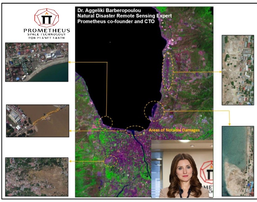
In a groundbreaking study, Prometheus co-founder Dr. Aggeliki Barberopoulou with talented researchers used satellite imagery and environmental indices to map the devastating 2018 Sulawesi Earthquake and Tsunami in Indonesia. By analyzing Sentinel-2 and Maxar WorldView-3 images, the team developed a simple, cost-effective method to assess tsunami damage.
Key Findings:
- Used NDVI, NDSI, and NDWI indices to quantify changes in land cover
- Identified most affected areas: urban center, low-lying regions, and coastal zones
- Demonstrated a low-cost approach for rapid disaster response
The research highlights the importance of quick damage assessment, as cleanup efforts can quickly obscure tsunami impacts. By using accessible, open-source data and straightforward techniques, the study offers a replicable framework for evaluating coastal disaster effects in resource-constrained regions.
This innovative approach provides valuable insights for disaster management and could help vulnerable coastal communities better understand and prepare for future catastrophic events.
You can read the full paper here


